
We are driving our motorbike in Central Asia and are often asked about the road conditions and border crossings. Here is an overview of the experience we have had so far with Central Asia roads and borders:
Aktau – Beyneu – Uzbek border (Kazakhstan)
- Azerbaijani-Kazakh border crossing (arriving by ferry from Azerbaijan): a disaster! It took us more than eight hours to leave the Kazakh border because there was always some papers missing. Someone told us later that the officers were expecting some kind of bribe to hurry things up…
- Road from Aktau to Beyney (470 kms): Not complicated at all, it is mostly tarred and the heat is probably your worst enemy (when riding in summer). Many places for stops over and to have some lovely sightseeing.The
- Road from Beyneu to the border (80 kms): The road is quite difficult, with many potholes and even sand on some stretches. But the good news is that a new road is being built (June 2018). Beyneu is your last chance to get petrol until… Nukus (if you want petrol from a petrol station).
- Kazakh-Uzbek border crossing: Very easy and quick on the Kazakh side.
Karakalpakstan – Nukus (Uzbekistan)
- Kazakh-Uzbek border crossing: Finally, the once difficult border of Uzbekistan is now getting an easy border, at least for tourists. Smiling officers, no luggage control, no complicated procedure. No extra payment required for the temporary import of our motorbike. After all, Uzbekistan is opening up to tourism!
- Road from Karakalpakstan to Nukus (400 kms): Gosh! We were happy when it was over!
 Sometimes it is a highway, but other times it is too damaged. The worst is the heat and the fact there are no localities in between, and hardly any shade. Bring plenty of water and petrol!
Andijan (Uzbekistan) – Osh (Kyrgyzstan)
- Unproblematic roads and area, with plenty of villages in-between
- Uzbek-Kyrgyz border crossing: also quite easy and quick on both sides, as a motorbike we were waved through so nowhere we had to wait under the hot sun. All were quite considerate of motorbikers.
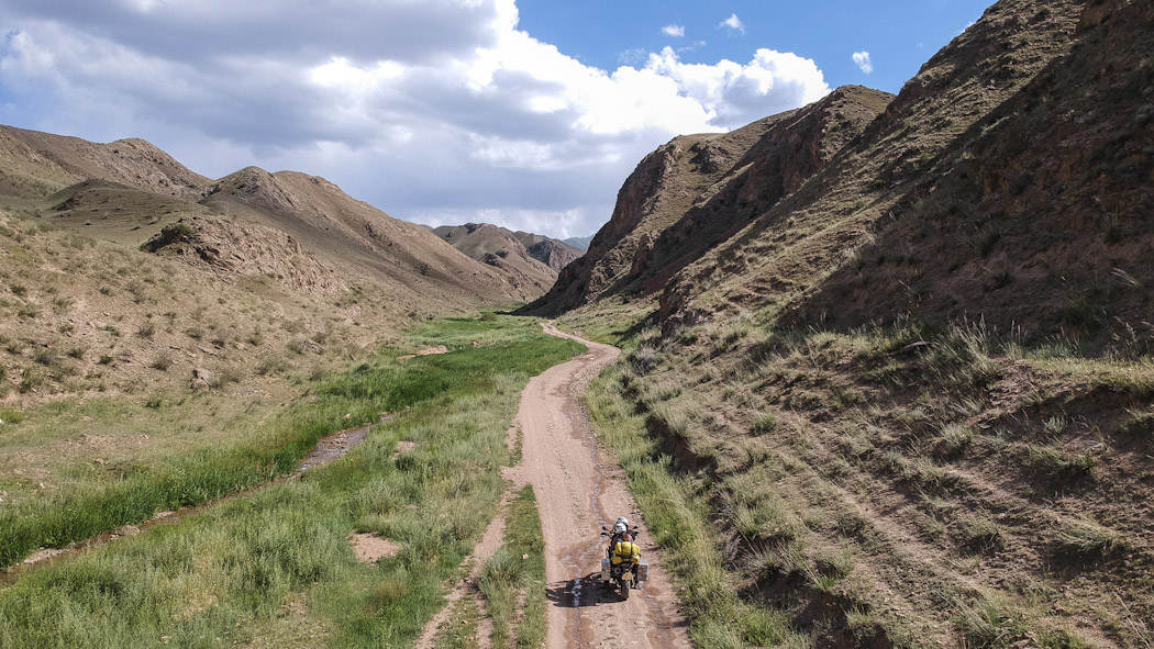
Osh – Sary Tash – Sary Mogul – Tulpar Kul (Kyrgyzstan)
- From Osh to Sary Tash there is a brand new tarmac road, almost like a highway, through a beautiful landscape.
- From Sary Tash the road gets less good, but still fairly decent until Sary Mogol
- From Sary Mogul to Tulpar Kul (which is next to Lenin’s base camp, and where there are beautiful lakes, a great place to camp) the road is practically none existent. It is off-road, occasionally even rough, but not impossible to drive through. Make sure to have some kind of GPS, as occasionally there are several tracks and it is difficult to know where to go.
Osh – Arslanbob (Kyrgyzstan)
- We had some doubts about this road because on the map it looked like a secondary road. No problems whatsoever. It is worth to drive it in order to spend some time in the most beautiful and largest nut forest in the world.
Torkent – Ala-bel Pass – Kyzyl-Oi – Aral (Kyrgyzstan)
- Tarmac from Torkent through the Ala-Bel pass. We did get some rain that was almost snow (and this in August). We ended up camping somewhere along the road, and it was one of the coolest nights we had in Kyrgyzstan.
- When approaching Kyzyl-Oi there is some off road along the river, but nothing very difficult
- Kyzyl-oi to Aral is also partially off-road through an amazing landscape
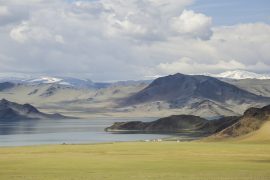
Aral – Song-Kul (Kyrgyzstan)
- This was probably our most difficult leg of all the trip so far. It was a rough gravel road, zigzagging up the mountain, on a very narrow trek with a precipice much too close to us. It was no fun reaching it, but of course, the view from above into the Song-Kul lake and the immense grassland was worth all the effort. However, it is possible to reach Song-Kul from the western side, from the road that connects it to Kochkor, which is a much better road, even if partly off-road.
- Careful when driving in Song-Kul, you may get too enthusiastic and end up in one of the natural ditches (streams?). We needed some locals to help us out of one such ditch.
Naryn – Tash-Rabat – Chatyr-Kol (Kyrgyzstan)
- Biggest difficulty after tarmac is the altitude. When we reached the alpine lake Chatyr-Kol (next to the Torugart pass at 3,752 metres), Jorge’s headache was so strong that we had to descend, so did not manage to go around the lake as was our original plan.
Around Issyk-Kul (Kyrgyzstan)
- There is one tarmac road all around the lake, and despite the road being good, this was the place where we got our sole puncture. For coming closer to the main attractions, one needs to leave the tarmac. Most highlights are easily visitable through some decent off-road treks (Fairy tale valley, Mud lake, Valley of flowers, Seven Bulls), so nothing to declare.
Bishkek (Kyrgyzstan) – Almaty (Kazakhstan)
- Kyrgyz-Kazakh border crossing: we had the feeling officials were competing to know who can be friendlier with tourists. All very easy and quick!
- The road that connects both cities is undergoing many works on different sections and it is also a road with much traffic, especially trucks, therefore not really fun, despite the view over snow-capped mountains when approaching Almaty.
Almaty – Big Almaty Lake (Kazakhstan)
- Apart from a few works on the road, that delay traffic, all the road up until the lake is tarmac. The disadvantage, of course, is that the lake will have plenty of other visitors…
Almaty – Charyn Canyon (Kazakhstan)
- It is 220 kilometres until the canyon. Most of the road is actually a brand new highway. Only around twenty kilometres of the road are in poor condition, with many nasty potholes.
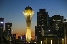
Almaty – Nur-Sultan (old Astana, Kazakhstan)
- We had heard that the road that connected Almaty to Astana (the one that passes near the Balkash lake) was in very bad condition. We didn’t find it very bad, but it is indeed a slow road for different reasons:
- Day 1 – Almaty to Ulken (365 km) – in the first kilometres after leaving Almaty the road is good, though there are many trucks that slow down the traffic (even though it was Sunday). About halfway to Ulken, the road gets bad, with some nasty potholes and in many sections there are road works (it looks like they are enlarging the road), with many trucks and caterpillars, this is a very dusty section and some off road, when traffic is detoured from the main road. It took us around eight hours to reach Ulken.
- Day 2 – Ulken to Balkash (270 km) – overall the road is in good condition; landscape gets a bit boring, always steppe. It took us five hours (with a very long lunch break to warm up, because the wind was strong and cold)
- Day 3 – Balkash to Karaganda (377 km) – very good road, it would have taken us more or less five hours to arrive in Karaganda, had it not been for the detours we made (a 24 km detour to approach the Bektau-Ata mountain, and a small stop to visit the Spassk Memorial).
- Day 4 – Karaganda to Nur-Sultan (212 km) – there is a brand new highway connecting the two cities, so we made it in less than two hours. There is a toll, but the good news is that motorbikes don’t need to pay it!
Nur-Sultan – Pavlodar (Kazakhstan)
- Contrary to what we had read, the road is in good condition. It is mainly asphalt, with the occasional road works with detours through dirt roads. We were also expecting many more trucks, but there weren’t too many, and having a truck to overtake even helped to keep one focused since the landscape is quite boring.
Pavlodar – Semey (Kazakhstan)
- It is 332 kilometres
Rubstovsk – Barnaul – Gorno-Altaysk – Aktash-Altai – Tashanta (Russia)
- We asked for a transit visa in Russia, to cross from Kazakhstan to Mongolia (roughly 1,000 kilometres). At the Embassy we were told that they calculated 500 kilometres per day – so we should be granted 2 days for transit. We complained that it would be too much for a motorbike, and the officer told us she would grant us five days. When we picked up the visa, we had been given 6 days. However, the 6th day fell on a Sunday and the Mongolian border would be closed, so we had to do it on 5 days.
- The roads are good, so it is quite feasible to drive this distance even in four days. But you wouldn’t want to rush through such a beautiful landscape.
Russian border to Olgii (Mongolia)
- The first 20 kilometres will give you a good feel of what roads in Mongolia will be like. It is good off-road, hard dirt roads, that can get slippery with rain, we were lucky, everything was dry when we passed here. The rest of the road to Olgii (80 kilometres) is in good tarmac.
Olgii to Altai (Mongolia)
- This is 650 kilometres of mainly a new asphalt road. On some sections, the new road is still closed and traffic is detoured through the old road, which is in bad condition. But the detours are never more than 3 or 4 kilometres. We also got one small river crossing (because the new bridge had fallen!!!), but when we passed this (in June), there wasn’t too much water (below knee level) and the bike passed it easily.
Altai to Uliastai (Mongolia)
- This was the most difficult leg of our trip in Mongolia (196 kilometres). The roads did not surprise us, we were expecting dirt roads. But on some stretches, there are several dirt roads and one doesn’t really know which one to choose. We reckon, they all probably lead to the same villages, but we were glad we were riding with another biker who had GPS. One or the other time, we did have to cross fields in order to join another dirt road, because the one we had chosen was leading us in the wrong direction.
- On this road, occasionally, we got sand. It wasn’t so much that we could not continue, but we did have to drive more carefully to try to avoid sandbanks. This was for about 10 kilometres only, more or less halfway through the distance between the two places. It really wasn’t much, we didn’t even fall!
Uliastai to Tosontsengel (Mongolia)
- This used to be another stretch of off-road. The good news is that it is dirt for only about the first 60 kilometres after you leave Uliastai and then it gets to be tarmac for the next 120 kilometres. BUT, the 60 kilometres that are not asphalt yet are in very bad condition. Because they are preparing the road for asphalt it really is 60 kilometres of washboard road! Therefore we decided to drive off the off road It was much more comfortable to drive on the grass, or through one off the smaller dirt tracks that on the road.
Tosontsengel to Tsetserleg (Mongolia)
Tsetserleg to Kharkhorin (Mongolia)
Kharkhorin to Ulaanbaatar (Mongolia)
If you found this interesting, you may also like the following:


Yes yes yes yes yes. This was exactly what I was looking for. Road conditions and passibility of some of these routes. Thank you for doing this.
Thanks for your feedback Tim! We have a few more updates to do to this article and are now more encouraged to keep this up-to-date! If you have any queries don’t hesitate to ask! Cheers
Great info thanks , I’m travelling along Africa twin now in baku waiting a call from ship guys to go to Aktau (kuryk) . Hopefully leave tomorrow or day after tomorrow . I know heat will be biggest challenge, I need to pass through uzbekistan to Tajikistan as fast as possible. My uz Visa is still 08.07.
Have a great trip Ajay!
Bonjour
Le site internet est très intéressant, je viens de le découvrir.
Je prépare un voyage pour 2026 de France à Vladivostok en passant par le sud, les “Stans”, pour aller et par la Russie pour le retour.
Je penses qu’il y a plein d’informations ici
A bientôt
Oups… Forgotten to translate my comment… Sorry